The first line of a Del Bonita history cannot be a homesteader’s arrival date. That date may begin one family’s connection with a property; it cannot explain everyone else’s relationship with the land.
The Blackfoot Confederacy’s own account provides the appropriate regional starting point. It describes Kitaowahsinnoon as a continuing homeland and identifies the four nations of the Confederacy: Kainai, Siksika, Piikani and Aamskapi Pikuni. The international boundary crosses this wider geography. Blackfoot Confederacy, Lands and Tribes
Last reviewed: October 28, 2026. This introductory article draws on published Indigenous and provincial sources. It has not yet been reviewed by an Indigenous community partner or knowledge holder.
A place in the landscape
The Hoyt Tipi Ring Site is a documented archaeological place near Del Bonita. Alberta’s register describes 176 tipi rings, 25 stone arcs and four cairns on a terrace above the North Milk River. It was designated a Provincial Historic Resource on August 30, 2007. Alberta Register of Historic Places, record 4665-1339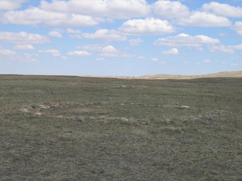
These counts describe what the record identifies at the site. They do not establish a population, one occupation date or a single camp containing 176 occupied tipis. The register discusses the likelihood of more than one camping event and the site’s potential to yield further information. Its description does not give this website a basis for assigning every feature to a named nation, family or event.
The distinction is important for the reader looking at an apparently precise number. An inventory can be exact about surviving features while leaving large historical questions open.
Reading archaeological records alongside living knowledge
An archaeological description and a community’s account of its homeland answer different questions. One can document physical traces and their condition. The other can explain relationships, language, responsibilities and meanings that an inventory does not contain.
The Confederacy presents its story in its own voice, including the relationship between history, land and language. That is a valuable place to continue reading. Blackfoot Confederacy, Our Story
Future articles should be shaped with contributors who can decide what knowledge is appropriate to publish, how it should be attributed and which names and spellings they prefer. An editorial invitation is not evidence that collaboration has already happened. No community endorsement is implied by this first article.
What the archive can do now
We can avoid describing the region as empty before agricultural settlement. We can distinguish an individual property history from the history of the land beneath it. We can make Indigenous-authored sources easy to reach and state the limits of our own evidence.
We can also leave space for correction. A label supplied by a collector or an old newspaper may tell us more about the writer than about the people described. If such material becomes part of the archive, its original wording and the present-day explanation should remain distinguishable.
Maps of the farming landscape
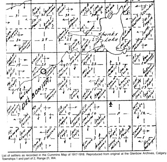
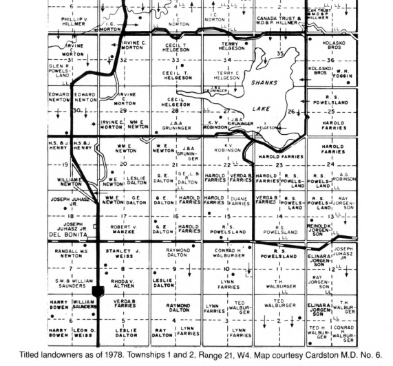
The township maps in Heritage of the High Country show a later layer of this landscape: surveyed sections, agricultural settlement and titled land. Shanks Lake appears in both details below, providing a point of comparison across six decades. These records of settlement and title sit within the longer history of the Blackfoot homeland described above.
1917–1918: the Cummins settlers’ map
1978: titled landowners around Del Bonita and Shanks Lake
Continuing this article
The next useful additions would be a contributor-led introduction to local place names, guidance on the relationship between this district and the wider homeland, and a reading list selected with Indigenous partners. Those additions deserve time and named authorship.
This page is for learning about the landscape, not a guide to entering an archaeological site. The archive does not provide field directions or imply public access to land.
Continue with the history of Del Bonita, or contribute a correction or suggest a source.