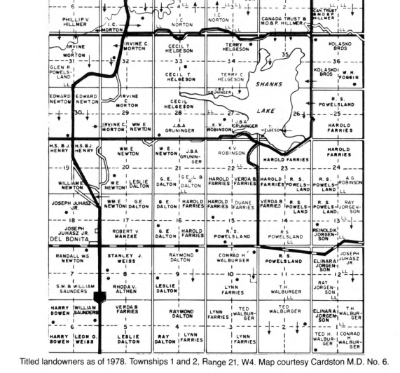
A historical titled-landowners map detail around Del Bonita and Shanks Lake, dated 1978 and credited to Cardston M.D. No. 6. It records historical ownership.
- Reference
- DB-A056
- Source reference
- DB-B001, printed p. 19
- Date
- 1978
- Date precision
- year
- What the date means
- The printed caption identifies titled landowners as of 1978. This dates the historical ownership record, not the book publication or present ownership.
- Source context
- Reproduced in Heritage of the High Country (Del Bonita Historical Society, 1981), p. 19.
- Creator
- Not named in the book
- Held by
- Cardston M.D. No. 6 (map credited in the printed caption)
- Research status
- Book page visually checked; image and provenance preserved
- Rights
- No image-specific open reuse licence is asserted.
Original source
The preservation collection holds available source files locally, outside the public site. Catalogue pages do not imply that a full-resolution image or the complete book has been obtained.
Explore the context
Last reviewed: 2026-11-01. Exact user-supplied PNG bytes, including the printed caption. The supplied image shows the lower part of the map on the book page, not the complete map. No further cropping, enhancement, resizing or recompression was performed.Copy provenance